
Data Hub Mapping Tools
This page can be downloaded as a PDF here
The guidance below illustrates how site data can be downloaded from the Data Hub as a .csv file. The downloaded data is easily transferable to create site maps using GIS, such as GIS Story Maps and embedded maps.
Download Data Site info to a .csv file
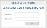
Contact ExtensionWater@montana.edu to obtain a username and password for this section if you do not
already have one.
- Navigate to the Data Hub (google Montana Extension
 Water; on MSUEWQ homepage, click on Data Hubicon)
 - Click on “Upload Data or Photos”
- Login using your username and password
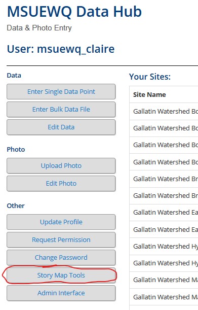
- Click “Story Map Tools”
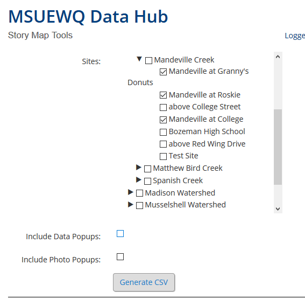
- Select the sites you would like to download site data for
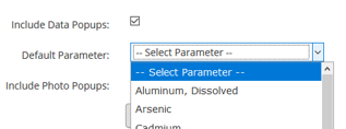
- Selecting “Include Data Popups” includes a link to the data hub data viewer for each downloaded site. The “default parameter” selection determines what parameter the link will direct to.
- Selecting “Include Photo Popups” includes a link to the data hub photo viewer for each site selected.
- Click “Generate CSV” and save the file.
- The downloaded .csv file will include the following
- Watershed Name
- Stream Name
- Site Name
- Site ID
- Site Description
- Site Lat and Long
- Data Viewer and Photo Viewer links if selected
Map Examples
An example Story Map and Embedded Map are available on the Data Hub Mapping Tools Web Page