
Exercise 2- Explore Photos
1. Navigate to the Data Hub (google Montana Extension Water; on MSUEWQ homepage, click on Data Hub icon)
2. Click on “Photo Viewer”
3. Use the drop down arrows under “Choose Sites” to select sites to view data for.
4. In the “Date Range” section, choose “View Entire Range” to see all photos available for your selected sites.
5. Note the “Loading Status.” Over a slower internet connection with a lot of users on the Wifi it may take a few moments to load.
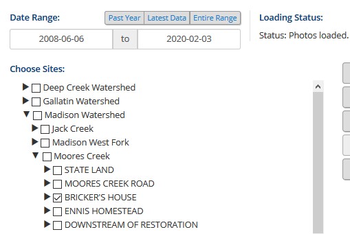
Photo Explore 1- Mandeville at Roskie
|
1. Select the “Gallatin Watershed” and “Mandeville at Roskie” 2. In the “Date Range” section, select “View Entire Range” 3. Above the photos, unselect “General” and “Whiteboard Photos” 4. Press the play arrow to see the slide show. 5. What date was the sod installed at the new dorms in the photo? |
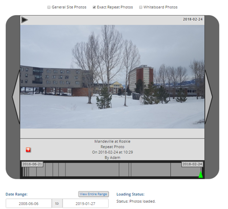 |
Photo Explore 2- Musselshell Careless Channel Vegetation
|
1. Select the “Musselshell Watershed” and “MSSL Above Careless Confluence” 2. In the “Date Range” section, select “View Entire Range” 3. Above the photos, unselect “General” and “Whiteboard Photos” 4. Press the play arrow to see the slide show. 5. There is a small off channel pond on the right of the photo. What years is it completely separated from the main channel by vegetation? 6. During what periods does the flow look particularly high at the site? |
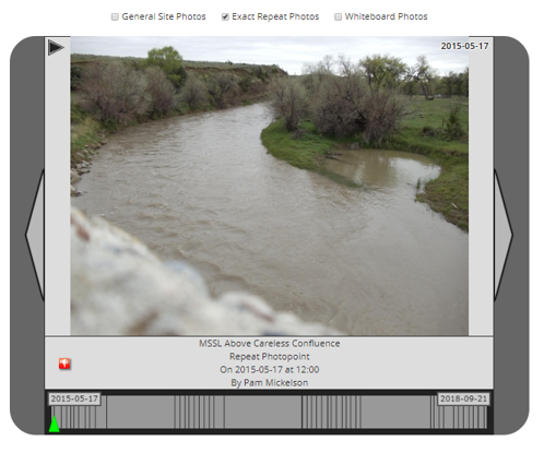 |
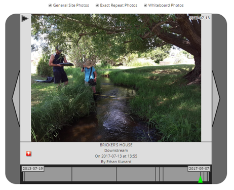
Photo Explore 3- Madison Flow Measurement
|
1. Select the “Madison Watershed”, “Moores Creek” and “Bricker’s House” 2. In the “Date Range” section, select “View Entire Range” 3. Above the photos, unselect “General” and “Whiteboard Photos” 4. Press the play arrow to see the slide show. 5. What days can you verify that discharge was measured at the site? |
 |